
Studies on spatial-temporal deforestation and land degradation patterns in eastern Africa
Within the Climate Change Impacts on Ecosystem Services and Food Security in Eastern Africa (CHIESA), the Geo-Information Unit is deriving spatial-temporal patterns on deforestation and land degradation in eastern Africa to guide decision makers as to where landscape rehabilitation measures can be effectively instigated.
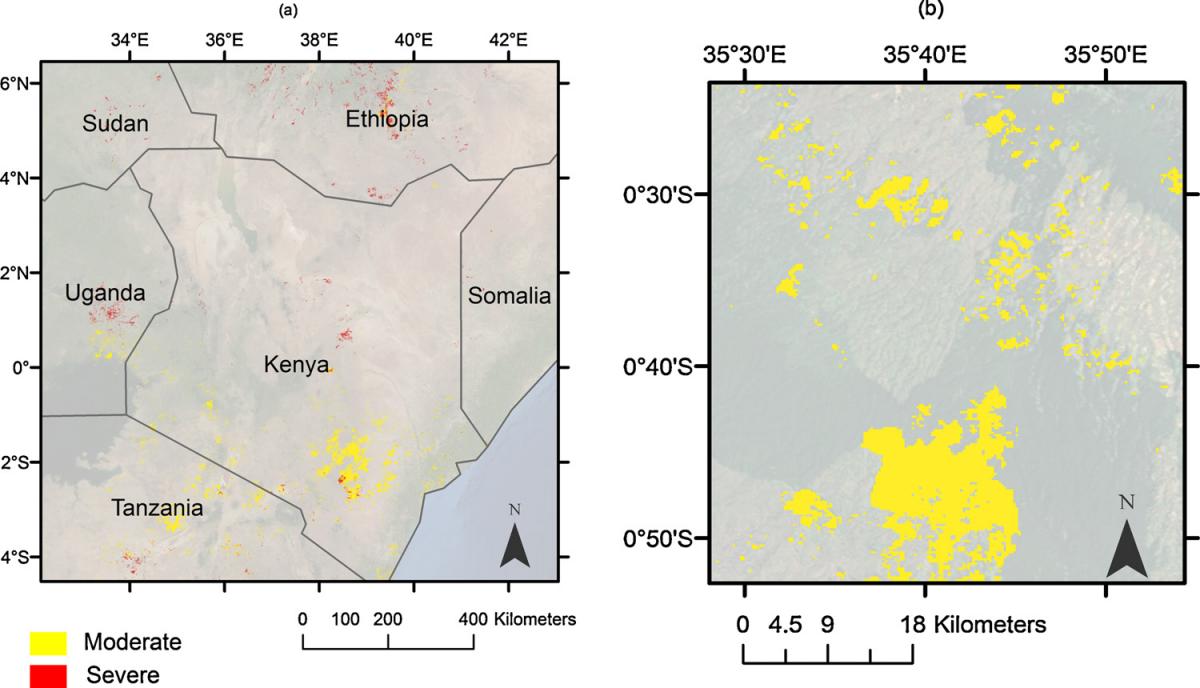
Map below indicates land productivity loss due to land degradation and deforestation between 2001-2012. Map A shows the eastern Africa extent, while map B shows the Mau forest (deforestation). Red illustrates severe productivity loss and yellow is moderate productivity loss. The productivity losses were mapped using a new formula computed from rainfall and satellite time-series data processed for east Africa.
Funding:
- Ministry of Foreign Affairs, Finland
Lead Partners
- University of Helsinki, Finland
- University of York, United Kingdom
- University of Dar es Salaam, Tanzania
- Sokoine University of Agriculture, Tanzania