Striga mapping in the context of Push Pull Sub-Saharan Africa
Our task is to ‘develop striga and stemborer density maps for individual countries in Sub- Saharan Africa to guide the scale out of the push-pull technology.
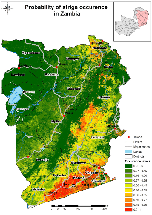
The unit uses a combination of remote sensing, bio-climatic variables and field-based occurrence data to develop ecological suitability envelopes (as probability maps) for striga and stemborers. The map below shows a Striga asiatica presence only probability map for Zambia. Red areas indicate high probability of occurence, while green indicate low occurence of Striga asiatica.
Funding
Biovision Foundation